Google Maps and QlikView
Looking to incorporate Google maps into a QlikView application? Well, you have come to the right place. First let me give you a little background on geocoding:
“Geocoding is the process of finding associated geographic coordinates (often expressed as latitude and longitude) from other geographic data, such as street addresses, or zip codes (postal codes). With geographic coordinates the features can be mapped and entered into Geographic Information Systems.” – http://en.wikipedia.org/wiki/Geocoding
In simple terms, geocoding turns location data (like zip codes) into a unique latitude and longitude and shows it on a map. Now you might be wondering what do geographic information systems (GIS) have to do with Google maps and QlikView. Well, we will be using geotagging to bring the two together, which means in this example we will add latitude and longitude metadata to states to establish where on the map you want to report on.
Best Practices
- Data cleansing. It is important to make sure the data is consistent. The developer can setup checkpoints to make sure the data is correct.
- Preparing a list for coordinates. Listed below are the types of reference points the developer can use to match with the coordinates. The one used is based on how granular the report should be.
- Country
- State or country sub region
- City
- Zip code
- Address
- Finding a list online. Don’t waste too much time finding coordinates yourself. There are tons of databases online you can download to use.
- Validating. Once everything is in place make sure the maps look right. For example, if your data is based in the states but China is showing something is wrong. Another great way to validate the data is enter to two mock locations that are close to each other and make sure they are close to each other on the map.
Why use QlikView?
One of the main benefits working with QlikView is the developer can be more productive in a quicker time frame. Instead of waiting for this amazing feature you can implement it in your existing applications today. Not sure if you have the means to do it yourself? I recommend US-Analytics, but of course I’m biased.
How it is done?
Ok, I know you really just want to get to the meat of this. You might be thinking, ” Now I know what this is all about, and I have to have it!” Wait no more.
I have displayed a step by step process on how to implement a Google map in an existing QlikView application. Assumption: the QlikView application has states and sale numbers.
Step 1: Get the example.
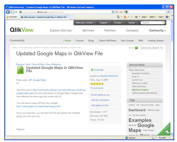
No need to recreate the wheel on this one. Go to the QlikView community site and download “Updated Google Maps in QlikView.”
Step 2: Prepare your script.
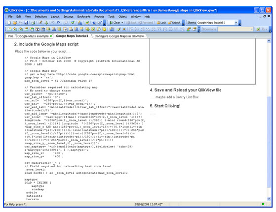
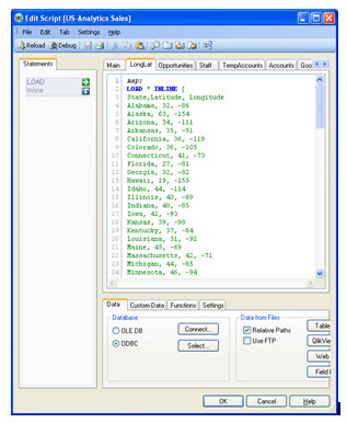
Open the download and in the tutorial sheet grab the code shown and place it in the script of your application. A table will also need to be added with a list of latitude and longitude that relate to the reference that you would like. For this example I am using states. There are tons of free databases you can download with zip codes. Here is one: http://databases.about.com/od/access/a/zipcodedatabase.htm
Step 3: Place the object.
Copy the object and background from the example to your application.
Step 4: Configure the object.
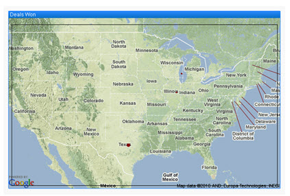
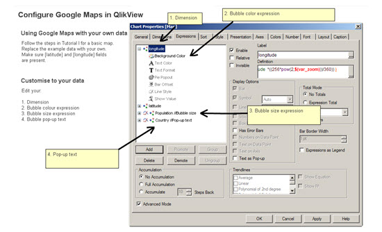
In the example, follow the steps listed in the configure Google maps sheet. Make sure you change the bubble size to calculate what you want. For my example I used total sales.
Step 5: Enjoy!
Now you can click away.


leave a comment